We use cookies to make your experience better. To comply with the new e-Privacy directive, we need to ask for your consent to set the cookies. Learn more.

Best Practices for Extracting Features
Have you used the Extract Features tool in SMS before? The Extract Feature tool lets you generate channel and bank arcs from elevation data. There are some tricks to optimizing the use of this tool. This post will review some of the best practices that you should follow when you extract features from elevation data in SMS.
Digital Dams
These are often artifacts from stamping channels or unprocessed LIDAR data and they can cause problems determining flow directions on the raster. The pre-processing engines (TOPAZ and TauDEM) fill these prior to computing flow directions, which can be a problem if the centerline strays from the thalweg and matching depth is computed off of the filled raster and not the original, which will also cause higher elevations along the channel above the dam. These can be fixed by either:
- Trimming the raster above the dam by right-clicking on the raster and selecting Convert To | Trimmed Raster using a Map Module polygon.
- Modifying elevations downstream of the dam to match correct stream thalweg elevations by right-clicking the raster and selecting Editing | Edit Raster using selected arc elevations.
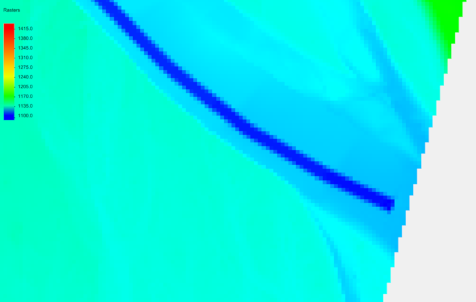
Placing Points for Extracting Bank Features
When extracting bank features, place the point closest to the most important area. For example, if a section is being used for bridge analysis, place the point close to the bridge. This allows the bank lines to stay the closest to the original feature. If the Extract Bank tool misses a bank section, try moving the point to the missed section and run it again.
Extracting Centerlines for Braided Streams
When extracting centerlines for braided streams, sometimes they may not follow the actual stream location because of digital elevation model inaccuracies. When this happens, extract both centerlines and manually merge the arcs into a single arc after both centerlines have been extracted.
Use the Depth That Is Option
The following guidelines should be observed when using the "Use the depth that is" option:
- If there is a single well-defined channel with a strong bank feature, use the "Closest to centerline" option.
- If there are multiple floodplain bank features, use the "Closest to previous" option, otherwise, the Extract Features tool may catch a different floodplain feature.
- If there are multiple channels or a braided stream (and you want to catch the widest extents of the channel), use the "Furthest from centerline" option.
Try out some of these best practices while extracting features in SMS 13.1 today!
December 1, 2021
|
View: 3300
|
Categories: SMS
|
By: <a class="mp-info" href="https://aquaveo.com/blog/author/admin">Aquaveo Staff</a>
About the Author

Performing a Silent Install of XMS (Passwords & Hardware Locks)
October 10, 2018
Computing Basin Curve Numbers in 9 Easy Steps
May 16, 2023
Converting a NET File to an INP File
May 9, 2018
Performing a Silent Install for ALS
October 27, 2021
Tips for Finding Information on the XMS Wiki
September 25, 2019
Comparing Multiple Design Alternatives in One Project
April 7, 2026
Incorporating MODFLOW 6 Groundwater Energy (GWE)
March 31, 2026
Essential DEM Clean-Up for Watershed Delineation
March 24, 2026
Essential Boundary Condition Guide
March 17, 2026
How to Delineate a Well Capture Zone Using MODPATH
March 10, 2026