We use cookies to make your experience better. To comply with the new e-Privacy directive, we need to ask for your consent to set the cookies. Learn more.
Subsurface Analyst
Create and visualize both 2D & 3D geologic models, starting with classification and visualization of borehole logs, creation and editing of cross sections, and generation of 3D geosections and geovolumes.
A number of easy to follow tutorials are available for Subsurface Analyst.
Compatibility
Subsurface Analyst is compatible with:
- ArcGIS Pro
- ArcGIS Desktop
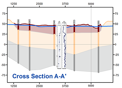
Create & Edit Cross Sections
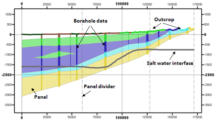
Interactive cross section editing of borehole data.
Include water table & saltwater interface and other geologic map data.
2D Cross Sections can be converted to 3D Geosections and viewed in ArcScene.
3D Geosections can also be converted to 2D Cross Sections to edit and view in ArcMap.
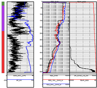
Create XS2D Geophysical Plot Features
Add geophysical plots to 2D cross sections. This tool creates features representing geophysical data, such as points, lines and polygon plots, along with scale bars, for use in an XS2D data frame.
Add Borehole Image Wizard
Add borehole images to cross sections. After selecting a particular well, run the wizard to register the borehole image. When finished, view the registered image in the cross section data frame.
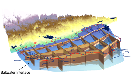
Generate 3D Geovolumes
Build 3D GeoVolumes from your subsurface data and visualize the new GeoVolume features in ArcScene.

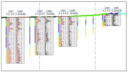
Classify, Visualize & Edit Borehole Data
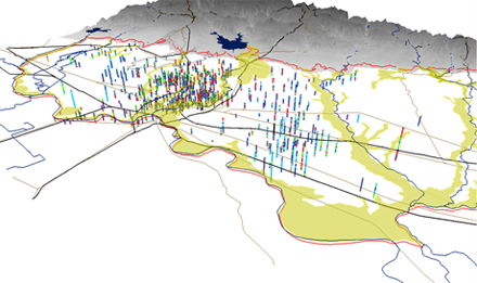
Build 3D GeoVolumes from your subsurface data and visualize the new GeoVolume features in ArcScene.
Geophysical Plot Tools
AHGW now includes geoprocessing tools for adding an XS2D display with multiple geophysical plots for a single well. Using a geophysical data table (such as one imported from a Log ASCII Standard file), multiple geophysical variables can be plotted alongside a well, with individual data scales (linear or logarithmic).
The Create Geophysical Plot Wizard can be used to create a new XS2D from a selected well.