We use cookies to make your experience better. To comply with the new e-Privacy directive, we need to ask for your consent to set the cookies. Learn more.
AGWA Web Application
Proactive stormwater management,
on a watershed level
Automated GSSHA
Watershed Analysis (AGWA)
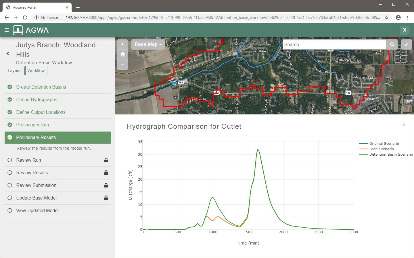
AGWA is an online web application for managing proposed changes to watershed models. The app is powered by GSSHA--a hydrologic model developed by the U.S. Army Corps of Engineers. It offers a user-friendly environment that automatically updates the underlying model, streamlining the use of watershed-level modeling to analyze the impact of stormwater events on your community.
Workflows - simple steps
for complex projects
The app employs step-by-step workflows to simplify complex watershed analysis. The workflows can be applied to any GSSHA watershed model that has been uploaded to the app server. It is designed for a variety of workflows to manage the local watershed change review process.
Workflows:
- Detention Basin Analysis
- Culvert Resize Analysis
- Find Discharge Tool
- Land Use Change Analysis (coming soon)
GSSHA - A Robust
Hydrologic Model
Gridded Surface Subsurface Hydrologic Analysis (GSSHA) is a two-dimensional finite difference rainfall/runoff model. A 2D grid is used to establish the domain and parameters for surface runoff. Features of GSSHA include 1D stream flow and infiltration, 2D overland flow and groundwater, and full coupling between the groundwater, shallow soils, streams, and overland flow.