Exporting 3D Grids to Shapefiles
By mkennard on March 1, 2012
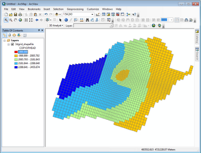
In GMS 8.2 we added the ability to export a 3D grid to a shapefile. All layers of the grid are exported, along with the active data set and the grid cell activity (IBOUND) and data set activity (dry cells) if they exist. Here is the list of the attributes that get exported:
- cell ID
- cell I
- cell J
- cell K
- grid cell activity
- active scalar data set values
- active data set activity (if it exists)


