Rasters
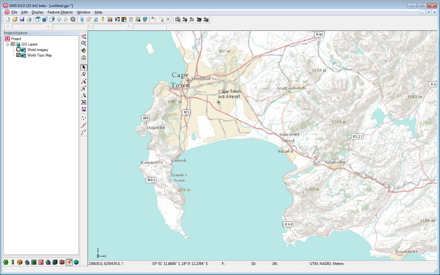
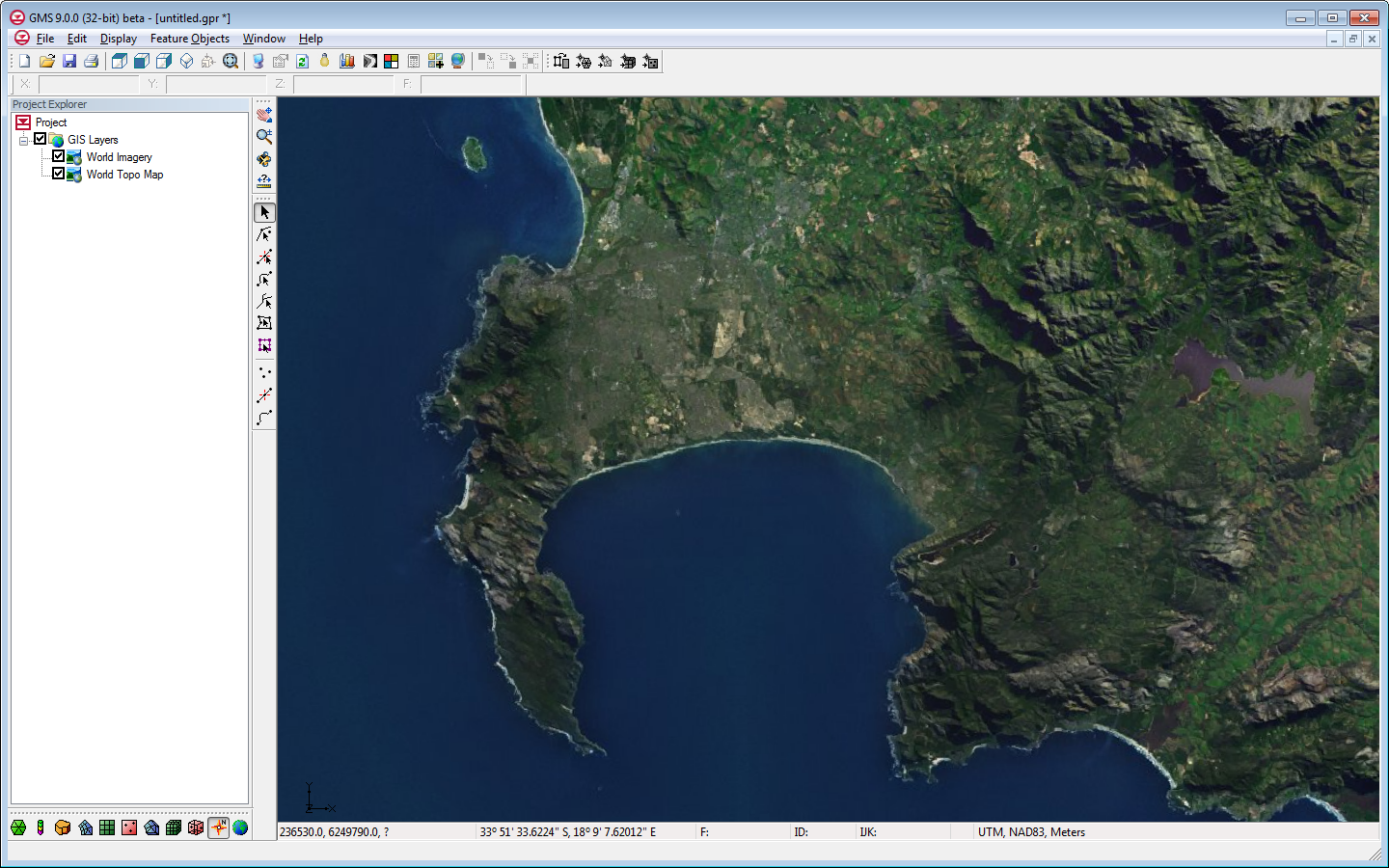
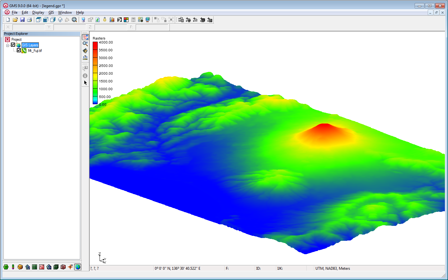
By mkennard@aquaveo.com on October 24, 2012A new image object type which we are calling a "raster" has been added with GMS 9.0. Rasters are essentially images with elevations - an image that includes a color value and a data value at each pixel. GMS uses the raster object type to support DEM files, and a large variety of DEM file types can be imported into GMS as rasters.
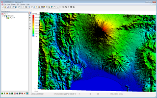

Rasters can be displayed as 2D images, with or without shadows, or as a 3D point cloud without shadows. Both options are very fast and memory efficient. Four different shaders, or color ramps, can be used to show variations in elevation.
Rasters can be interpolated to all other GMS object types as well as to MODFLOW layer data (similar to 2D scatter points). They can be created inside GMS from 2D scatter points.
A wiki page has been created to document the raster interface in GMS and a new Raster tutorial will be available when GMS 9.0 is released.