We use cookies to make your experience better. To comply with the new e-Privacy directive, we need to ask for your consent to set the cookies. Learn more.
Converting an Unprojected Raster to Vector Maps in SMS
In the field of hydraulic engineering, understanding flow dynamics in channels is crucial for effective design and analysis. Converting unprojected rasters with u and v components from a Large Eddy Simulation(LES) model to a vector map in the channel can provide valuable insights. However, this process can be challenging without the right workflow. In this post, we will explore one approach to achieve this in SMS.
- Preparing the Data
To begin, project component rasters to the correct coordinate system. This ensures that the data is in the correct coordinate system for further processing. This can be done in SMS by importing the raster data in the GIS module. Then use the projection command - Importing and Triangulating the Ugrid
Next, drag the projected rasters in and convert the u component raster to a Ugrid format using the Raster to Grid tool in the toolbox for SMS 13.2. However, since the resulting Ugrid is created from a raster, the data points are not triangulated for proper interpolation. To address this, select the Ugrid in the project explorer and choose Cells | Triangulate. This allows the data to be interpolated across the surface accurately.
Alternatively, you can create your own UGrid that encompasses the raster area. Make certain the UGrid has the correct projection. - Incorporating Bankfull Channel Bathymetry
To add the bankfull channel bathymetry from a raster, interpolate the bankfull elevation to the UGrid points. Use the Data | Map Elevation command to overwrite the existing Z dataset with values from the bankfull dataset. This step ensures that the bathymetry aligns with the UGrid for an accurate representation of the channel.

- Displaying Vectors and Refining the Results
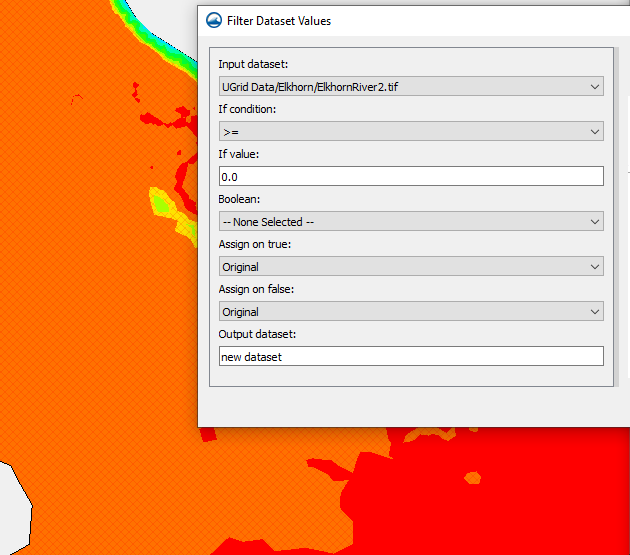
After combining the u and v components, display the resultant vectors. However, it is common to encounter null vectors outside the channel, which may disrupt the visualization. To address this, utilize the filter and map activities in the dataset toolbox. These tools enable you to mask or remove the null vectors, ensuring a clean representation of the flow hydraulics in the channel.
By following this workflow, you can effectively convert unprojected rasters with components from an LES model to a vector map in the channel using SMS. Proper triangulation, incorporation of bathymetry data, and handling null vectors are critical for accurate visualization of flow dynamics. SMS proves to be a valuable tool in streamlining this process, empowering professionals to gain deeper insights into channel hydraulics and make informed decisions for various engineering applications.
Try out working with raster data in SMS today!


